MapExplorer

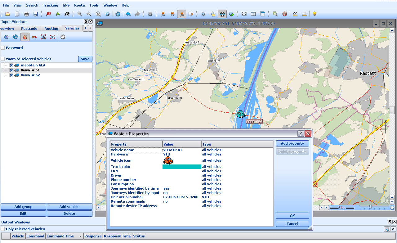
MapExplorer offline mapping software screenshot

PC Mapping Software

MapExplorer is a complex mapping software for Windows that is designed for routing and route optimisation, offering a wide range of great features.

Features overview

  • Detailed search for addresses and map objects (e.g. Points of Interest) or by postcodes or coordinates
  • Route optimisation with unlimited waypoints
  • Online GPS tracking and electronic logbooks (available only with MapFactor Vehicle Tracking)
  • Communication with Actis SatNav or PC Navigator
  • Import of waypoints from your databases
  • Supports import from a variety of formats
  • Map customisation
  • For free with every PC Navigator order

Search

  • MapExplorer can find addresses up to house numbers. Or you can search map objects – Points of interest, water supplies, beaches, mountains, etc.
  • Search in user defined area.
  • Search by postcodes. Moreover in Great Britain search by detail postcodes which leads you directly to your destination.
  • Seach of nearest objects.
  • Search of coordinates in various coordinate systems

Route Optimization

  • Entry of unlimited user waypoints, with MapExplorer calculating the best route.
  • Option to automatically reorder waypoints for the most efficient route.
  • In MapExplorer TRUCK, input detailed vehicle parameters (e.g., dimensions, weight) for a precise, vehicle-specific route.
  • The route provides details on:
    • Distance on toll roads,
    • Estimated fuel consumption,
    • Approximate fuel cost.
  • Customizable settings for road type preferences and speed limits.

Working with the Map

  • Measure distances and azimuths between points.
  • Add custom objects (like pushpins) to the map.
  • Adjust GPS settings and rotate the map for easier navigation.
  • The map window can be saved as an image file or copied to the clipboard.

Import of Waypoints from Databases

  • Waypoints can be imported from various file formats, including ArcInfo, MapInfo, GPX, DBF, Access, Excel, ODBC, PostgreSQL, CSV, SQLite, and EXIF data from JPGs.
  • You can set zoom levels and use custom icons for waypoints on the map.
  • Imports can be scheduled to update automatically whenever MapExplorer starts or at set intervals.
MapExplorer screen

MapExplorer and Vehicle tracking

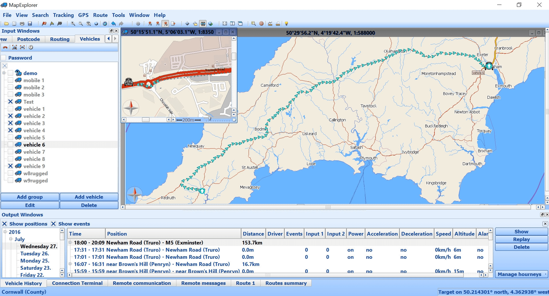
All our Tracking4Free GPS vehicle trackers come with MapExplorer – our street-level offline mapping software. The GPS tracker automatically reports when the vehicle is on the move. MapExplorer processes and evaluates all recorded data, assisting you in tracking and managing your vehicle fleet effectively. Its key functions include displaying passed routes, replaying vehicle movements, generating statistical reports, and providing an electronic logbook.

crosshairs-gps
Localisation
texture-box
Geofencing
message-alert-outline
SMS Alarms

Position Display

  • Display of current vehicle position on the map.
  • View past vehicle positions for up to 6 months.

Alarms

  • Geofence alarms: Receive notifications when entering or exiting user-defined areas, including geofences along specific routes. Create an unlimited number of geofence areas.
  • Power cable alerts: Get notified if the power cable is unplugged or if the defined speed limit is exceeded. Additionally, receive alerts for changes in binary inputs.

Electronic logbook, reports and statistics

The electronic logbook is automatically generated from stored information, including date, time, and location data received from the Tracking4Free tracking unit. The system operates without driver intervention, ensuring the accuracy of the recorded data.
  • Reports can be generated either manually or automatically, such as on a monthly basis. They can be saved to a specified directory or sent via email.
  • The basic report includes date, time, starting and destination positions, distance travelled (in kilometers), driver name, trip type, status of outputs and inputs, and an estimation of fuel consumption.
  • The detailed report provides all street names, date, average speed, and distance covered.

Additional Report Types

  • Labour day reports and breaks
  • Group reports
  • Inputs reports
  • Graphical reports
  • Business/private journey reports
  • Last known positions of all selected vehicles

Import and Export Options

These reports allow you to import your favourite places (e.g., home, office, clients). Instead of addresses, user-defined names will be displayed directly.

MapExplorer offers the option to export reports to various logistics systems, fleet management software, Excel, Google Maps, and other formats. This facilitates further analysis and management of the data.

How we can help you?

Reach us out with your questions.

Contact us